
Constructing non-overlapping concentric buffers over linestrings
Published:
TL;DR: We will learn how to construct multiple non-overlapping buffers around linestring objects using PostGIS in PostgreSQL.
Requirements
Ensure that you have Postgresql installed on your computer, we will use the terminal for this post but you can also install the pgadmin interface if you prefer a GUI. You can see installation instructions for postgresql here and download pgadmin here.
If installed correctly, you can initialize and then start the postgres database as follows:
sirchidi:~$ initdb /usr/local/var/postgres -E utf8
sirchidi:~$ pg_ctl -D /usr/local/var/postgres -l /usr/local/var/postgres/server.log start
After the second command, you should see something like this:
sirchidi:~$ waiting for server to start....done
server started
You can also check the status of the server using
sirchidi:~$ pg_ctl -D /usr/local/var/postgres status
If it is unable to start server, you can do
sirchidi:~$ killall postgres
to kill any old processes that may be interfering and then retry the above commands.
sirchidi:~$ whoami
For this post, we will be using a very small .csv file containing the coordinates of six streets, and can be downloaded from here.
Okay, all set, lets begin.
Methods
We can split this section into three sub-sections
- Reading from file
- We have to ensure that the files are read correctly into a postgresql table and persisted correctly. Every operation will be done on this table.
- Buffer Construction
- This is where we reason about to perform the construction of the multiple buffers.
- Writing to file
- Finally, we write the constructed buffers from the postgresql table back to a file.
Reading from file
To read the file and persist to a table in the postgres database, we can switch to the postgresql terminal as follows:
sirchidi:~$ psql -d postgres
This let’s us use the postgres database.
Then, we create a table streetSample with three columns to correspond with the number of columns in our .csv file.
CREATE TABLE streetSample(
street text,
osmid text,
geom text);
Next, we need to create a postgis extension for the database and a spatial index for the new table
CREATE EXTENSION postgis;
CREATE INDEX streetSample_index
    ON streetSample
    USING gist (geom);
Now, we copy the file from local to the table thus:
COPY streetSample (street, osmid, geom)
FROM '/path/to/file/on/local/streetSample.csv'  DELIMITER ',' CSV HEADER;
Finally, to finish up this sub-section, we have to set the crs code and column type for the geom object to 4326 which is the crs for lat-long coordinates.
ALTER TABLE streetSample
    ALTER COLUMN geom
    TYPE geometry
    USING ST_SetSRID ((geom::geometry),4326);
Buffer Construction
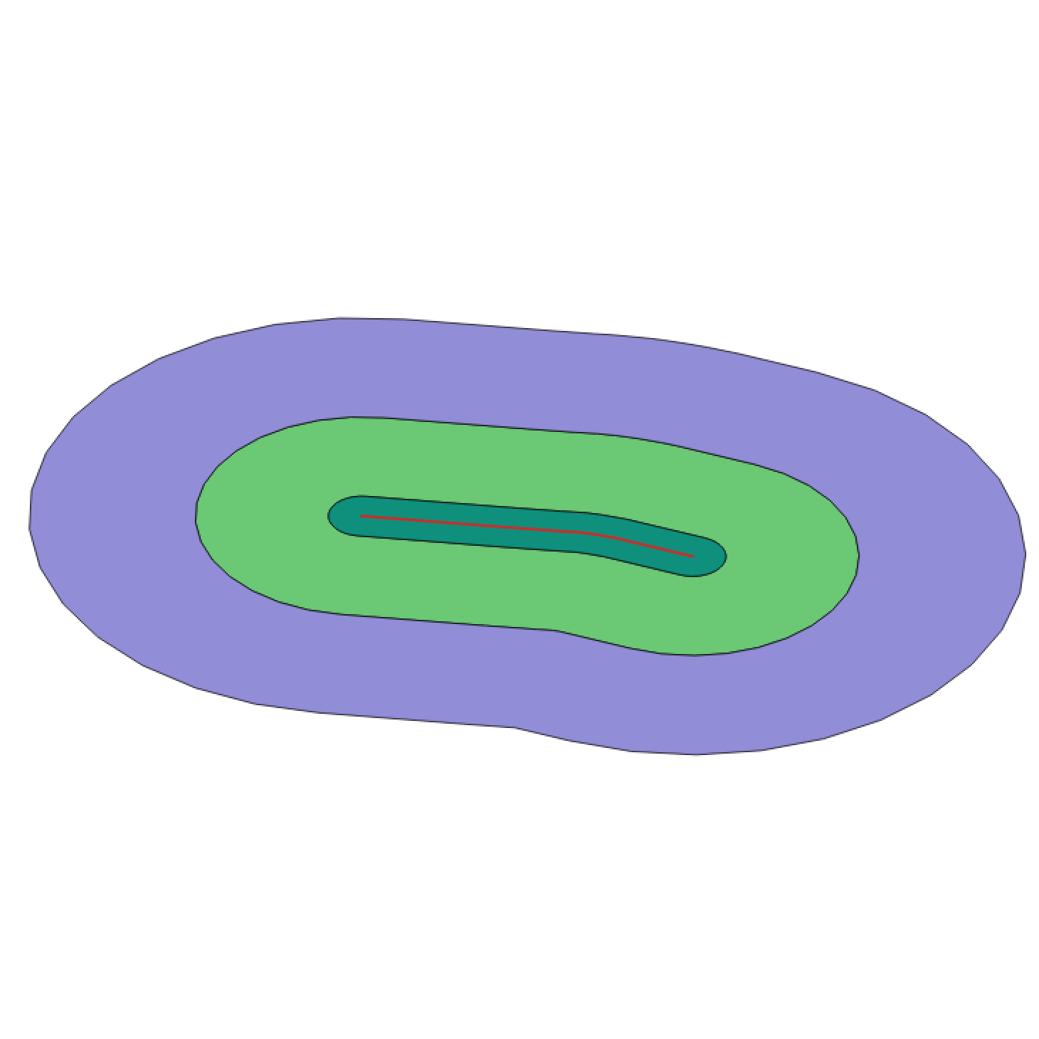
We will now construct three buffers, the first buffer will have a radius of 20 metres, the second one will be of 100 metres and the last one will be of 200 metres.
But first, we create three columns in the table for the buffers.
ALTER TABLE streetSample  ADD COLUMN buffer_20_metres geometry (Geometry, 4326);
ALTER TABLE streetSample  ADD COLUMN buffer_100_metres geometry (Geometry, 4326);
ALTER TABLE streetSample  ADD COLUMN buffer_200_metres geometry (Geometry, 4326);
Then, we update the new columns using the constructed buffers.
UPDATE streetSample  SET buffer_20_metres = ST_Transform(ST_Buffer(ST_Transform(geom,3857), 20,  'endcap=round join=round'),4326);

UPDATE streetSample
    SET buffer_100_metres =
        ST_Transform(
            ST_Difference(
                ST_Buffer(ST_Transform(geom,3857), 100,  'endcap=round join=round'),
                ST_Buffer(ST_Transform(geom,3857), 20,  'endcap=round join=round')),
                4326);

UPDATE streetSample
    SET buffer_200_metres =
        ST_Transform(
            ST_Difference(
                ST_Buffer(ST_Transform(geom,3857), 200,  'endcap=round join=round'),
                ST_Buffer(ST_Transform(geom,3857), 100,  'endcap=round join=round')),
                4326);
Notice how we transform between two crs’s, that is because the 4326 does not support the metres unit we need to define the buffer radius. Thus, we temporarily transform the linestring coordinates to a metre-crs for the buffer creation in each sql statement and transform back to the working crs. Another thing to bear in mind is the option for the buffer construction endcap=round join=round. This option can also be changed, please refer to the postgis documentation here.
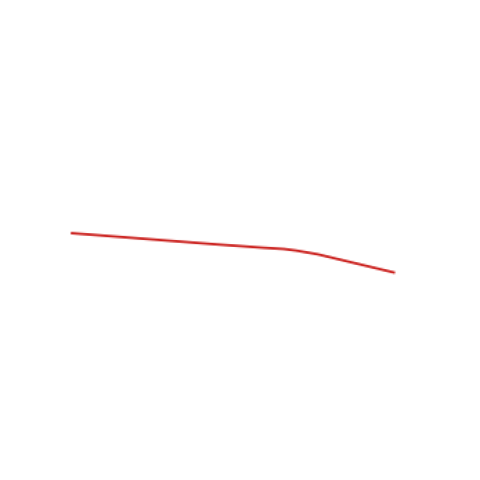
Now, we show a visualization of the buffers:



And, all buffers superimposed on the linestring.
Our buffers are created and we have to write back to file.
Writing to file
We write the updated table to .csv using:
COPY
    (
    select
        street,
        osmid,
        ST_AsText(geom) AS geom,
        ST_AsText(buffer_20_metres) AS buffer_20_metres,
        ST_AsText(buffer_100_metres) AS buffer_100_metres,
        ST_AsText(buffer_200_metres) AS buffer_200_metres
    from streetSample
    )
TO '/path/to/file/streetSample_with_buffers.csv' DELIMITER ',' CSV HEADER;
Final words
I hope this helps someone, the SQL queries for this post is available here. If you have any queries, please leave a comment below or open an issue in the code repo. Thanks!
Leave a Comment